
 Raymarine
Yamaha · Whaly · Terhi · YAM · Milha
GPS & CHARTPLOTTERS AVAILABLE.
Marine equipment, parts and chandlery in stock, with support from the Flood Marine team in Omagh.
Shop Categories
Filter Products
Price
Search products
Brands
Product Role
Raymarine
 Raymarine
 Raymarine
 NASA
NASA
NASA Clipper Depth Display Only
40mm high digits. Depth below transducer / below keel / below surface. Deep and shallow alarms (audible and visual). User selectable Feet or Metres. Intelligent gain control + manual overide. Selectable display rate and depth averaging rate. Indicators for Depth trend, No Echo. High transmit power. Output for repeater. Consumption 20mA + 25Ma for backlight (max).
£176.14 inc VAT
Add to basket
 NASA
NASA
NASA Clipper Log Display Only
40mm high digits Speed (Knots/m.p.h.). Trip Distance (N.Miles / Miles). Total Distance (N.Miles / Miles). Trend indicator shows acceleration / deceleration. Selectable speed averaging. Tactile keypad. NMEA 0183 output VHW & VLW. Display only - no transducers included.
£176.14 inc VAT
Add to basket
 Airmar
 Scanstrut
 NASA
NASA
 Scanstrut
Scanstrut DS-H6 Grey Plastic Horizontal Cable Seal 2-6mm OEM 10 Pack
Our most compact horizontal entry IP68 cable seal OEM 10 Pack (No retail packaging) For cables from 2-6mm (0.08"-0.24"), an aesthetic dome-shaped profile provides a stronger, impact-resistant design and captive nuts in the base make for an easy assembly.
£179.81 inc VAT
Add to basket
 Scanstrut
Scanstrut DS-H6-BLK Black Horizontal Cable Seal 2-6mm OEM 10 Pack
Our most compact horizontal entry IP68 cable seal, OEM 10 Pack (No retail packaging) For cables from 2-6mm (0.08"-0.24"), an aesthetic dome-shaped profile provides a stronger, impact-resistant design and captive nuts in the base make for an easy assembly.
£179.81 inc VAT
Add to basket
 Raymarine
 Garmin
Garmin BlueChart G3 – HXEU010R: Spain Mediterranean Coast
BlueChart g3 coastal charts provide industry-leading coverage, clarity and detail with integrated Garmin and Navionics data. Also included is Auto Guidance technology, which uses your desired depth and overhead clearance to calculate routes and provide a suggested path to follow — overlaid onto your chart. NOAA raster cartography is also available as a free downloadable feature via the ActiveCaptain app. It gives your chartplotter paper chartlike views of NOAA-surveyed areas in which individual points of interest are labelled with corresponding longitude and latitude information. Worldwide coverage is available by regions as accessory cards or via download; each region is sold separately. Compatable with ECHOMAP™ Plus series chartplotters.
£180.79 inc VAT
View product
 Garmin
Garmin BlueChart G3 – HXEU012R: Mediterranean Central-West
BlueChart g3 coastal charts provide industry-leading coverage, clarity and detail with integrated Garmin and Navionics data. Also included is Auto Guidance technology, which uses your desired depth and overhead clearance to calculate routes and provide a suggested path to follow — overlaid onto your chart. NOAA raster cartography is also available as a free downloadable feature via the ActiveCaptain app. It gives your chartplotter paper chartlike views of NOAA-surveyed areas in which individual points of interest are labelled with corresponding longitude and latitude information. Worldwide coverage is available by regions as accessory cards or via download; each region is sold separately. Compatable with ECHOMAP™ Plus series chartplotters.
£180.79 inc VAT
View product
 Garmin
Garmin BlueChart G3 Regular Area – HXEU013R Italy Southwest & Tunisia
BlueChart g3 coastal charts provide industry-leading coverage, clarity and detail with integrated Garmin and Navionics data. Also included is Auto Guidance technology, which uses your desired depth and overhead clearance to calculate routes and provide a suggested path to follow — overlaid onto your chart. NOAA raster cartography is also available as a free downloadable feature via the ActiveCaptain app. It gives your chartplotter paper chartlike views of NOAA-surveyed areas in which individual points of interest are labelled with corresponding longitude and latitude information. Worldwide coverage is available by regions as accessory cards or via download; each region is sold separately. Compatable with ECHOMAP™ Plus series chartplotters.
£180.79 inc VAT
View product
 Garmin
Garmin BlueChart G3 Regular Area – HXEU014R Italy Adriatic Sea
BlueChart g3 coastal charts provide industry-leading coverage, clarity and detail with integrated Garmin and Navionics data. Also included is Auto Guidance technology, which uses your desired depth and overhead clearance to calculate routes and provide a suggested path to follow — overlaid onto your chart. NOAA raster cartography is also available as a free downloadable feature via the ActiveCaptain app. It gives your chartplotter paper chartlike views of NOAA-surveyed areas in which individual points of interest are labelled with corresponding longitude and latitude information. Worldwide coverage is available by regions as accessory cards or via download; each region is sold separately. Compatable with ECHOMAP™ Plus series chartplotters.
£180.79 inc VAT
View product
 Garmin
Garmin BlueChart G3 – HXEU015R: Aegean Sea & Sea of Marmara
BlueChart g3 coastal charts provide industry-leading coverage, clarity and detail with integrated Garmin and Navionics data. Also included is Auto Guidance technology, which uses your desired depth and overhead clearance to calculate routes and provide a suggested path to follow — overlaid onto your chart. NOAA raster cartography is also available as a free downloadable feature via the ActiveCaptain app. It gives your chartplotter paper chartlike views of NOAA-surveyed areas in which individual points of interest are labelled with corresponding longitude and latitude information. Worldwide coverage is available by regions as accessory cards or via download; each region is sold separately. Compatable with ECHOMAP™ Plus series chartplotters.
£180.79 inc VAT
View product
 Garmin
Garmin BlueChart G3 Regular Area – HXEU061R France Inland Waters
BlueChart g3 coastal charts provide industry-leading coverage, clarity and detail with integrated Garmin and Navionics data. Also included is Auto Guidance technology, which uses your desired depth and overhead clearance to calculate routes and provide a suggested path to follow — overlaid onto your chart. NOAA raster cartography is also available as a free downloadable feature via the ActiveCaptain app. It gives your chartplotter paper chartlike views of NOAA-surveyed areas in which individual points of interest are labelled with corresponding longitude and latitude information. Worldwide coverage is available by regions as accessory cards or via download; each region is sold separately. Compatable with ECHOMAP™ Plus series chartplotters.
£180.79 inc VAT
View product
 Scanstrut
 Garmin
Garmin GPS 73
This easy-to-use handheld GPS is the perfect navigational solution for boats, sailboats or small watercraft that do not have a chartplotter. It’s also ideal as an emergency navigation backup for all vessels. Its high-sensitivity GPS marks and stores 1,000 waypoints and 100 tracks so you can navigate right back to them. Use on land or water — it floats! Features SailAssist, including virtual starting line, heading line, countdown timers and tack assist.
£184.01 inc VAT
Add to basket
 Garmin
Garmin GST 43 Speed & Temperature Thru-Hull Transducer
The GST 43 is a thru-hull transducer that can read water speed and temperature. The transducer can retrofit an existing Nexus 43mm thru-hull transducer (TH43). When installed with the optional GST 10, the GST 43 can connect directly to the NMEA 2000® network, and the information can be displayed on a compatible Garmin chartplotter or instrument display. (The GST 43 & GST 10 are available as a bunde see part number: 230-0100428400)
£184.01 inc VAT
View product
 Garmin
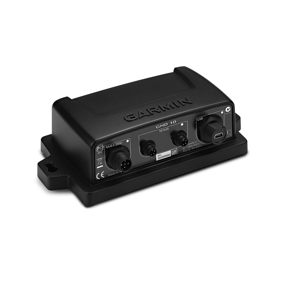
Garmin GND 10 Black Box Nexus to NMEA 2000 Bridge
The GND 10 black box bridge seamlessly integrates Nexus instruments and sensors with the Garmin family. It converts data between the Nexus Network and NMEA 2000 to provide compatibility between Nexus and Garmin products, including gWind, gWind Wireless and gWind Race transducers. Simple plug-and-play installation between Nexus and NMEA 2000, with USB connectivity, eliminates the need for user setup and system configuration. GND 10 allows PC applications, such as NexusRace, Expedition, Adrena or SeaTrack, to communicate sailing-specific functions between Nexus and NMEA 2000 networks. It also enables GND 10 software updates over NMEA 2000. Existing NexusRace PC application can be used to update software, configure and calibrate Nexus devices over USB using the FDX protocol. In The Box GND 10, USB Mini-B cable, NMEA 2000 drop cable (2 m), NMEA 2000 T-connector, Nexus network cable (5 m; straight connector), Mounting hardware, Documentation.
£184.01 inc VAT
View product
 Garmin
Garmin GNX Keypad For Large Format Marine Instruments
Control a compatible GNX instrument display from a distance with this push-button keypad interface which can be fixed-mounted near the helm. It features 4 buttons dedicated to preset configurations. Plus, you can adjust the background lighting of all displays with the touch of a button.
£184.01 inc VAT
View product
 Veratron
 Veratron
Veratron VMH Flex – 1.4″ Colour Multi Function Display – NMEA 2000
Small but powerful, the VMH Flex is the perfect compromise to display a large amount of boat data in a compact device. No matter if wearing gloves or if it is raining on your deck, the innovative laser touch button allows users to scroll up to 5 different screens. NMEA 2000 Version
£184.01 inc VAT
Add to basket