Description
- Ultrawide in-plane switching (ips) 15-inch display fits a variety of helm layouts including “floating display” configurations
- Connect to compatible third-party devices with digital switching and onehelm integrations
- Easily build a marine system by using our advanced network connectivity
- Navigate waters confidently with support for garmin navionics+ and garmin navionics vision+ charts
- See below the boat with built-in sonar capabilities
- Manage the marine experience from nearly anywhere
Gain a panoramic perspective
Sleek Modern Design – Offering a stunning display with minimal trim borders and edge-to-edge glass the GPSMAP 15×3 chartplotter features an ultrawide high-resolution touchscreen interface with the familiar easy-to-use functionality of Garmin’s existing GPSMAP x3 series chartplotters.
Bright and Clear Optics – This versatile chartplotter’s ultrawide IPS display provides wider viewing angles accurate colours superior clarity and sunlight readability – even with polarised sunglasses.
Split to Fit – Experience the benefits of dual screens with the convenience of seamless control. Split-screen functionality lets users size and organise the display configuration to put the data needed right where its wanted.
Two Mounting Options – A bail-mount option with inset knobs and a bracket supports unique “floating display” installations (sold separately) while a rear-mount option is provided for secure flush- and flat-mount helm solutions.
See the world below
Traditional and Scanning Sonar Support – Get built-in support for 1 kW CHIRP traditional sonar for superior target separation. Plus Ultra High-Definition ClearVü and SideVü scanning sonars feature vivid high-contrast colour palettes to help distinguish fish from structure (transducer required – sold separately).
Panoptix Sonar Support – Pair with Panoptix or LiveScope easy-to-interpret live sonar (transducer required – sold separately) to see all around the boat in real time.
Made for the helm
Mapping – Navigate with optional Garmin Navionics+ charts that include Auto Guidance+ technology daily updates and more (subscription required).
Premium Charts – Get support for Garmin Navionics Vision+ charts with premium relief shading and satellite imagery.
Sail and navigate with ease
Garmin SailAssist Sailing Features – View laylines race start line guidance enhanced wind rose heading and course-over-ground lines true wind data fields and tide/current/time slider wind angle set and drift wind speed and more.
Sailing Polars – Use the polar table to see key data including how fast the boat should go at a certain wind angle and speed – Helps sailors know when to adjust sail trim.
Garmin Marine Network – Share information such as maps user data radar and IP camera video with multiple compatible Garmin devices on the boat.
NMEA 2000 and NMEA 0183 Networks – Connect to compatible autopilots digital switching weather the Fusion audio system media VHF AIS and more from one screen.
ActiveCaptain App – Built-in Wi-Fi connectivity pairs with the free all-in-one mobile app for access to the OneChart feature smart notifications (when paired with a smartphone) software updates Helm app Garmin Quickdraw Community data and more.
Integrated ANT Technology – Connect with other devices such as quatix marine watches gWind Wireless 2 transducers GNX Wind marine instruments and wireless remote controls.
Engine Connectivity – Connect the chartplotter to different engines including select Yamaha and Mercury engines.
OneHelm Feature – This feature brings together all of the operations and capabilities of EmpirBus digital switching and other third-party devices on one screen.
Send InReach Device Messages – Pair an inReach satellite communicator to the chartplotter and type custom messages by using the MFD’s on-screen keyboard. Access the contact list or enter an email inReach address or phone number. It can also send group messages by conversation for a texting-like experience.
Connect with additional boat control options
Power-Pole Shallow Water Anchor – By networking the GPSMAP 15×3 chartplotter with a Force trolling motor and a compatible Power-Pole shallow water anchoring system Access advanced boat control features from the plotter including smart anchor auto-deployment smart anchor jog auto stow anchor drag detection and end-of-route anchoring. Spend more time fishing less time positioning.
Trolling Motor Integration – Get support and integration for any Force series trolling motor (sold separately) to gain more control while fishing.
In The Box
- GPSMAP 1523xsv ultrawide chartplotter
- Power Cable
- Thin flush mount kit with gasket
- Protective Cover
- 8-pin transducer to 12-pin sounder adapter cable
- 2 m backbone/drop cable and T-connector for NMEA 2000 Network
- Documentation
Compatible & Related Products
Useful compatible products and accessories recommended for this item.
 Garmin
Garmin GDT 43 NMEA 2000 Depth & Tempreture Thru-Hull Transducer
This Thru-Hull Transducer Can Read Water Depth And Water Temperature. It Can Retrofit An Existing Nexus And Silva 43 Mm Thru-Hull Transducer (TH43). When Bundled With The NMEA 2000® Adapter, The GDT 43 Can Connect Directly To The NMEA 2000 Network, And The Information Can Be Displayed On A Compatible Garmin Chartplotter Or Instrument Display.
 Garmin
Garmin Panoptix PS21-TM Forward Transom Mount Transducer
It’s very unnerving, to say the least, in unfamiliar waters, and an obstacle or sand bar suddenly appears. So Garmin designed Panoptix PS21-TM with FrontVü sonar to give boaters enhanced situational awareness.¹ FrontVü sonar shows approaching obstacles, sandbars and other hard obstructions to give you time to respond and avoid a collision or running aground. It’s a great way to protect your boat and your passengers.
 Garmin
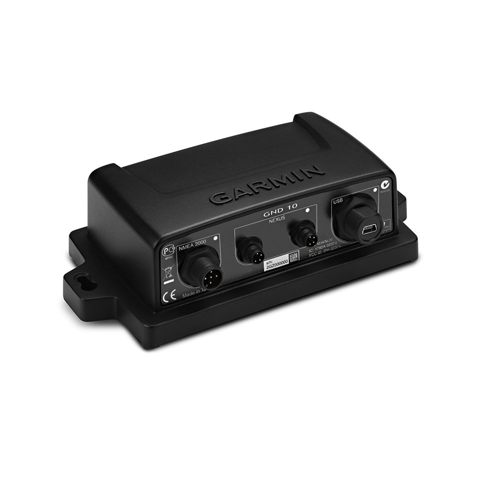
Garmin GND 10 Black Box Nexus to NMEA 2000 Bridge
The GND 10 black box bridge seamlessly integrates Nexus instruments and sensors with the Garmin family. It converts data between the Nexus Network and NMEA 2000 to provide compatibility between Nexus and Garmin products, including gWind, gWind Wireless and gWind Race transducers. Simple plug-and-play installation between Nexus and NMEA 2000, with USB connectivity, eliminates the need for user setup and system configuration. GND 10 allows PC applications, such as NexusRace, Expedition, Adrena or SeaTrack, to communicate sailing-specific functions between Nexus and NMEA 2000 networks. It also enables GND 10 software updates over NMEA 2000. Existing NexusRace PC application can be used to update software, configure and calibrate Nexus devices over USB using the FDX protocol. In The Box GND 10, USB Mini-B cable, NMEA 2000 drop cable (2 m), NMEA 2000 T-connector, Nexus network cable (5 m; straight connector), Mounting hardware, Documentation.
 Garmin
Garmin SteadyCast NMEA 2000 Heading Sensor
SteadyCast heading sensor is a simple, easy-to-install solution that provides fast calibration and premium heading accuracy. It aligns your boat bow to its actual orientation so you know where you are casting according to your chartplotter screen.
 Garmin
Garmin Grid 20 Remote Input Device – Horizontal
The easy-to-use GRID 20 remote input device provides intuitive remote access and control of your entire Garmin marine system. It features a 360-degree joystick with a rotary knob and push-to-select button for easy chartplotter menu/setting navigation and fine control, even in the worst conditions. You can designate four favourite keys to restore your system to a previously saved configuration.
 Garmin
 Garmin
 Garmin
Garmin Navionics+ Chart: EU628L – U.K. Ireland & Holland
Detailed coverage of the UK, Ireland and the North Sea and English Channel coasts. Coverage includes the Shetland Islands, Orkney Islands, Isle of Man, Isle of Wight, the Isles of Scilly, the Channel Islands, the Thames River, the IJsselmeer, the Waddenzee and the Kiel Canal. Ports include London, Liverpool, Southampton, Edinburgh and Belfast, UK; Dublin and Cork, Ireland; Brest, Le Havre, Calais and Dunkirk, France; Antwerp, Belgium; Amsterdam and Rotterdam, The Netherlands; Bremerhaven, Hamburg and Kiel, Germany. Supplied on a SD-Card (Micro SD With SD-Card Adapter).